
Economically, California is not yet in ascendance. But ascendance is in California. In fact, you could say we're celebrating its 150th anniversary. That anniversary is not the occasion, per se, for what you're reading now. Rather, it's the introduction in the latest of John Summerson's books on climbing by bike.
Just out is The Complete Guide to Climbing (By Bike) in California. You might remember something from last October on Slowtwitch called, Climber's boxed set. I wrote about Summerson's book on the toughest cycling climbs in the U.S., juxtaposing that with Donald Culross Peattie's wonderful tome on Western Trees.
My premise is best stated by asking if you remember, in A River Run's Through It, what it was the river ran through? Answer: Montana. (I'm glad you asked.) When ascending on bike, A Highway Runs Through It. Runs through what? I think you might want to know what you're riding through, given enough fitness and wherewithal to be looking at something other than your bottom bracket during the exercise.
I'll talk for a moment, then, about this new book, but I'll also introduce you to two others, both books about climbing adventures in California, both autobiographical, contemporaneous accountings of first ascents commenced and accomplished 150 years ago to the year.
First let's talk about Summerson's new book. A friend of mine, arriving last night and staying in our guest house, saw The Complete Guide to Climbing by Bike in California in my living room and stole it. He's already an owner of Summerson's book that's national in scope and now he has the California-specific version—until I steal it back.
And that's the thing about Summerson's books: They're not only readable, they're devourable. They're at once curl-up-with, as well as reference, books. The California version is the second of Summerson's geo-specific books: Last year he published The Complete Guide to Climbing (by Bike) in the Southeast.
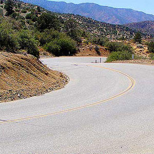
If you're a Left-Coaster, In California expands to cover several important—if secondary in difficulty—ascents and regions. None of the ascents in the Santa Monica mountains made it into the national book, and Summerson's algorithm for divining an ascent's difficulty proves (as I have been saying to the few who're interested) that this area's toughest climb is neither Latigo Canyon, Deer Creek nor Decker Canyon, rather it's Las Flores (a wonderful ascent emanating from downtown Malibu, reminiscent of the Maritime Alps, that most West L.A. Folks understandably ignore as they ride toward the lesser ascents further West).
Summerson also gets into the tall weeds of the Sierran ascents, ferreting out for display Portuguese Pass, one of California's most magnificent bike riding roads, the more so a Shangri La due to this paved road's lack of appearance on any map I've ever seen.
Should you ever find yourself on the Eastern side of the Sierra Nevadas, climbing the toughest grouping of ascents in America, and maybe the World, or spinning up roads closer to L.A. or perhaps the Bay Area's Mt. Diablo or Mt. Hamilton, the very first people to take a systematic look at this landscape were those comprising the California Geological Survey. Not unlike Thomas Jefferson's tasking of Lewis and Clark to explore the almost-one-million square miles of Louisiana Purchase, America needed to kick the tires of its new, mineral-rich acquisition of California. Ten years after California's admittance to the Union the California Geological Survey was dispatched.
Its leader was Josiah Whitney, and alongside him were chief botanist William Brewer, and Brewer's later addition to the team Clarence King. The best, and best known, book recounting the early years of the Survey was that of Brewer, Up and Down California in 1860-1864: The Journal of William H. Brewer.
The Survey was not just of the High Sierras, where Mt. Brewer and, of course, Mt. Whitney sit, but of all of California's mountains, including the San Gabriels and Santa Susannas of Southern California and the Santa Lucias and Mt. Diablo area proximate to the San Francisco Bay. Indeed, just about every place Summerson profiles a climb for a bike, The California Geological Survey was traipsing it on foot, on horseback, or on muleback.

What did the Survey members do during idle time? Just what we do. They climbed. Clarence King is credited with many first ascents in the Sierras, and, you'll find his adventures chronicled in his eminently readable Mountaineering in the Sierra Nevada.
The difference, a century and a half ago, was the abject lack of knowledge about what lay beyond the next ridge. Adjacent is a section of an antique map of mine, drawn from that period. Note the lack of any specificity attending the High Sierras. The passes, the heights, the width of the range were just not known. Hence the need for the Survey.
The best of California's ascents are not tackled via day trips from any well populated area. The Owens Valley climbs, or those in the Southern Sierras, are best explored over a 2 or 3 day weekend. Brewer and King are each worthy companions accompanying you on an exploration of California's topography.